Tuesday 29 January 2013

Orroral Heritage Trail

Trevor suggested that we do a walk this week and thought that perhaps one in Tidbinbilla would do however I have pretty much exhausted the Tidbinbilla walks so I figured that it was time to look at some of those in the Namadgi National Park.

Namadgi covers a huge area and there are plenty of trails. Some are short, others longish. Some are easy, others moderate while others are just plain hard. I selected that Orroral Heritage Trail as it was longish, 12km return, but only classified as moderate. Trevor did not want a walk that was overly difficult and this one seemed to fit the bill.

So, today, after lunching at Brothers Oven we headed off. We were equipped with our day packs and were carrying wet weather gear as the day promised some rain. In reality were were carrying almost a much as we will be on most days when we do the Coast to Coast walk. We were wearing our hiking boots as I was expecting the ground to be wet following the recent rain. We also had our short gaiters to combat the effect of grass seeds on our socks.

To get to the start of the walk we had to travel through Tharwa and then towards Adaminaby, along Naas Road. We called in to the Namadgi Visitor Centre to check that the chosen trail was open and to use their toilet facilities. According to the ranger on duty their was no problem with the trail however it might be a bit wet underfoot.

Our starting point was some 19km from the Visitor Centre. From Naas Road we took Boboyan Road and then Orroral Road which we followed until we reached the Orroral Campground, our starting point. The road was sealed all the way out but quite narrow and windy. There were a number of low level crossings which were not to be crossed if covered with water. Fortunately the crossings were dry. A number of rural properties still operate through this area and passed the odd cluster of farm buildings. These places really are isolated, tucked into valleys with steep sides.

There were no cars in the carpark when we arrived so we were able to select a shaded spot in the hope that the clouds continued to clear.

A lovely old tree in the camping ground
The camping ground was quite spacious with reasonable facilities given its remoteness. Perhaps we should consider a camping trip one of these days ... on seconds thoughts perhaps not!

The camping ground is tucked down near the Orroral River and the trail follows its course up the valley, sometimes quite close to the river and at other times moving away from it and up on to higher ground away from the marshy flats.

The track meandered up and down through open forest with a grassy understory. the track was generally quite narrow forcing us to walk in single file for much of the first few ks. While there were a few large trees, as evidenced by the one down at the campground, most of the trees were saplings leading us to conclude that they have grown since the 2003 bushfires raged through the area.

The slender trunks of the saplings suggest that most are quite young


 Along the trail were notice boards providing information about the area and features that we encountered. While some of the boards were faded the intent was good and it provided sufficient information to keep up our interest. It always helps to have an idea of what it is you are actually looking at.

Every now and then we saw clusters of huge granite boulders scattered randomly about.Geologically, the area started life as ocean floor on which silt was deposited over eons. The ocean floor was then thrust upwards and now sits some 900m above sea level. The surrounding hills range from 1200m to over 1600m above sea level.. As we saw when walking in the Victorian alpine region the uplift has exposed the layered rock and this has then eroded. Next came volcanic action ... hence the granite tors and boulders which are a feature through our local ranges.


The boulders were huge. Perhaps I should have got Trevor to stand beside them to demonstrate their size.

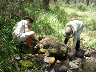
A number of wooden bridges crossed streams, some of which had water, others dry even though there had been recent rain. Eventually we came to a footbridge across the Orroral River which took us out of the forested area and onto the cleared valley floor.

The babbling brook otherwise known as the Orroral River
Once over the river we started encountering track markers. These were important as there was quite a bit of marshy land to cover and picking the wrong path could have left us with very wet feet.

A guide post. Can you spot the next one?
By this time the clouds which had looked like they were clearing had decided to return.

We are quite used to seeing kangaroos, sometimes in quite large mobs, around the Taylor Nature Reserve and Michael and I have seen large gatherings of roos on some of the meadows at Tidbinbilla but I was not prepared for the number of kangaroos we encountered today.


The kangaroo population in Namadgi was definitely going strong.

The Orroral Valley is long and wide and the early settlers had taken advantage of its terrain and cleared much of the valley floor and then ploughed the resulting cleared land. The slopes are well timbered even following the fires of recent times.


The site of the first European settlement in the area is marked by a plaque. There is no substantive evidence of that original dwelling or any of the other buildings.

Continuing up the valley, crossing a number of swampy areas, we finally sighted the Orroral Homestead. Scattered across the valley were a shearing shed, which was used for local dances and currently is in a state of disrepair, the remnants of the 1950s house which was removed after it had been vandalised, an orchard and the Orroral Homestead.

View up the valley with the homestead and other bits and pieces


Fences have been erected around all but the shearing shed although most are in a state of disrepair. Kangaroos were everywhere. I am not sure what the fences were meant to stop.

Kangaroos under an apple tree in the remains of the orchard
The remains of the 1950s house
Here is a series of photos of the Orroral Homestead which probably dates back to the late 1860s. It was built of slabs and consisted of three rooms with a separate kitchen. Only a chimney remains from the kitchen. There is a verandah along the front of the homestead which looks out onto the Orroral River and Cathedral Rocks  which stand out on the ridge across the river.

The back of the house

The front of the house with the verandah
The kitchen chimney stands a little way from the back of the homestead

And here is the shearing shed:


A short distance from the homestead were dilapidated cattle yards which were occupied by kangaroos!


By the time we left the homestead it had started to rain. We did put on our rain jackets and we were pleased when the rain cleared as the day was reasonably warm and it was hot walking in the jackets.

The last part of our walk was along part of the Australian Alps Walking Track which runs from Walhalla through the Victorian Alps through the Snowy Mountains and then Namadgi ending up at Tharwa. We had walk along bits of this track during our Great Alpine Walk week.

We continued up the valley towards the site of the Orroral Tracking Station which had operated in the valley from 1965 to 1984 before being dismantled. The remains have got informative explanatory plaques.

There is a picnic area at the with tables dotted around a shady area. You can also get to the site without doing the 6km walk that we did.

Looking back along the valley over the remains of the dish platform
After wandering around the tracking station site and visiting their welcome toilets we headed back the way we had come.

We encountered more light rain but decided to keep going without rain jackets as it was still quite warm.

Trevor stopped on the track with examples of the regrowth all around
All in all this was quite a pleasant walk over relatively flat terrain. The round trip of just on 12kms took just under 3 hours which included frequent photo stops as well as plaque readings and checking out the homestead and the other relics.

I'm pleased that I wore my hiking boots as the track was often rough and rocky when it was not marshy/swampy.

And as for the kangaroos ... what can I say? We did see quite a few birds. There was plenty of evidence of rabbit activity, freshly dug holes with rabbit droppings nearby, however we only saw two rabbits. Perhaps we would have seen more if we were walking in the early morning.


Tuesday 22 January 2013

Great Alpine Walk: day 7

Today was going to be a reasonably easy day as much of the time was taken up with the return trip to Melbourne.

Breakfast was scheduled for 7:30am so we had set the alarm for 6:30 and did the final pack of our bags. Today we had opted for a light backpack for our walk along with runners on our feet rather than hiking boots.

Packed, we headed over to the Snowline Hotel where breakfast was to be served. We were a few minutes early and sat outside with the other earlybirds waiting for the doors to open.

Along with cereals, juice and yoghurt we were provided with a cooked breakfast. Scrambled eggs, bacon served with a tomato chilli jam on crusty toast. I had tomatoes rather than the bacon. It was far too much delicious food for this time of the morning.

Hot drinks included cappuccinos which was most welcome.

The luggage was stowed and we were off by 8:30am driving from Harrietville to Bright. The local Shire has gone to a great deal of effort to put up signs announcing the names of the areas, villages and towns. Smoko caught my fancy. I wonder what the background to the name is.

A market was being set up in the area of Bright where Phil had planned to park the bus so we were dropped instead and the bus parked elsewhere.

Our walk today was a gentle one along the Bright Canyon. It was a pretty stretch of the river with quite a lot of interesting geological features. The group enjoyed walking across the suspension bridges, too. All up the route covered 3.5km.

Our morning tea break was in Bright and Trevor and I enjoyed a drink while we watched the world wander by.

Back on the bus we headed for Melbourne with a lunch stop in the very dead town of Euroa. Almost nothing was moving in the town at 1:30 on a Saturday afternoon.

We had one further quick (toilet) stop before reaching Melbourne where the first drop off point was the airport. About half of the group was flying home on the Saturday. The next stop was the Alto in Bourke Street. This was a bonus as the trip notes said that the only city drop off would be at the Robinson. We didn't mind at all as it meant that we could get an earlier train out to Glen Waverley.

Jen collected us from the Glen Waverley station.

Trip completed.

Keep an eye out for the trip summary and the flora post. I'll get to them over the next couple of days.


Great Alpine Walk: day 6

The alarm rudely woke us at 6:00am. We spent a little while repacking our bags which had been tossed as we searched for hats and other items to lend to fellow walkers.

The breakfast once again was very nice. This morning I decided scrambled eggs and tomatoes would be the go and they were very nicely done.

We left Dinner Plain at 8 and headed through Hotham to the start of our walk along Razorback and out to Mt Feathertop. From the road we could see the path going along the ridge and, just before a climb, divide with one continuing up the ridge while the other skirted around the side. Fortunately we were taking the lower track which Phil told us was actually the quickest route. He got no complaints from us.
Looking out along Razorback


The start of the Razorback Trail
I had checked the log before setting out and found the entry for Prue and Brenton so they had tackled Mt Feathertop on the previous weekend as they had planned.

We had been warned that the track was stony and rocky for much of the way out and it was. It was hard underfoot. Phil set a fairly fast pace for the lead group. We stopped from time to time to make sure that everyone was accounted for before pushing on. Storms had been forecast for later in the day and this, in part, may have been the reason for the speed.

One of the stops with l-r: Trevor, Phil and Maria

Morning tea break

Due to the uneven surface, and the sometimes quite narrow track, much of the walking required close attention to where we were putting our feet. At times the track clung precariously close to drops. Not for the fainthearted!


The rough and stony track across Razorback
Some of the rocky surface we walked over. Note the upright sharp shale.
 The track was often narrow necessitating us to walk in single file.

Trevor is at the back of this group heading along this narrow trail

Often the views were obscured by vegetation so watching our foot placement meant that we were not missing as much as would have been the case if there was no view blocking trees.

Looking over the ranges from the Razorback Trail

Beside the path we were delighted by a glorious array of alpine flowers cheerfully showing their colours for our enjoyment. I must check whether dandelions are natives as they were growing in profusion through the areas ion which we walked.

All but one of the group had opted for the walk through to Harrietville. Maria turned back before reaching the start of the ascent up Mt Featuretop so that she could pick up Trish along the track back to the start of our walk and drive the bus down to Harrietville.

The wind had come up and at times it sounded like waves breaking on the beach. Quite eerie so high up.

Just before the track up to the summit of Mt Feathertop we spied Federation Hut and its most welcome toilet. Visiting these facilities had to wait until after our attack of Feathertop.

Phil gave permission to Joan, Maria Teresa and I to commence the climb up Mt Featuretop sand for us then to come down and go on the Harrietville.

Trevor had opted to stay at the junction and guard the track to make sure no one escaped.


Trevor (lying down in the centre) guarding the track
The climb was made difficult by the rocky surface, loose stones and narrow track. There were times when the track narrowed and hung out over drops.

 The wind also added the the challenge as it buffeted us throughout the climb.

These rocky, uneven steps were a welcome part of the climb up Feathertop
The flora changed during that final ascent. There was still the odd tree, but they were quite rare. Flowering plants were in profusion along the track and across the slops.


If we had thought that the insect life was busy during the earlier part of our walk it had nothing on the insects that assaulted us up on the top. I was pleased that I was wearing long pants.
The final bit of track to the top with hikers savouring the views.
We sat down on the rocky summit and ate our lunch while fighting off the insects. As we ate the rest of the group arrived in ones and twos.

The views across the ranges back to Hotham and down into the Ovens Valley provided quite a contrast to that from Mt Tabletop. The footprint of man was very evident in both directions. According to my GPS reading we reached 1901m which is the highest I was on this trip.
View from the top of Mt Feathertop looking towards the Ovens Valley

Lorraine on top of Mt Feathertop
Refreshed we headed down the mountain with me in the lead. I think I had an advantage as I didn't have poles to contend with on the narrow track. The training I have down on the rough tracks on Mt Arrawang and Mt Taylor meant that I was used to tackling uneven surfaces and coped quite well with the climb down.

Back at the junction we picked up Trevor and headed over the Federation Hut. This is a relatively new structure and was equipped with mobile phone connection points. The toilets were most welcome and used by most the group even if the supply of toilet paper had been exhausted. I knew that I had carried toilet paper for a reason.

Being suitably relieved we prepared to head down the track to Harrietville. Trevor, Alec and Marie-Louise joined Joan, Maria and I. Making sure that Phil would be informed as to who was in the lead party we set off down the mountain. We were facing an altitude drop of around 900m across 9km of track. Maria lead us down with me taking up the rearguard position. We made good progress down the mountain. It was encouraging to get notification of how we were progressing by my Runtastic app at each completed kilometre.


Making our way down to Harrietville: l-r: Marie-Louise, Trevor, Alec, Joan (most obscured by Alec) with Maira in the lead.
About a third of the way down the temperature started to rise and the humidity increased markedly. Both got worse the further down we went. The vegetation also changed. We left the alpine flora behind and moved into tall mountain ash, bracken and other ferns and a variety of different plants. The snow gums disappeared.

The downward track had been hacked out of the mountainside and this probably left many of the trees a little more vulnerable. There was evidence of the destructive power of wind and water with a significant number of fallen trees both above and below the track. In places trees had fall adjacent to the track and the huge root balls lay next to what was left of the track. In some cases the roots had been wrapped around numerous rocks that lay exposed in the tangle of roots of the fallen giants. In some places the track had almost been wiped out by the falling of the trees and care was needed to negotiate the significantly narrowed tracks where this occurred.

One of the many trees that has fallen next to the path and taken a chunk out of the track

In other places toppled trees lay across the track and we had to scramble over them.

Marie-Louise scrambling over a tree which had fallen across the track
As we zigzagged down the mountain we needed to make sure that everyone in the party was adequately hydrated. Alec and Marie-Louise did not have bladders so we needed to make sure that they had regular drink stops. Marie-Louise confessed that she and Alec had not started out with adequate water and they were pleased that Phil had pressed a 1.25l bottle of water on to them.

Part way down Maria Teresa started to be troubled by a sore knee and she and Joan dropped back to the rear of the group so that she could nurse her knee during the remaining descent.

Trevor took up the lead position.

As we descended we started to see the township below us through the trees.

Some of the lush vegetation encountered on the bottom half of the drop down to Harrietville
Even though we continued to drop Harrietville kept appearing to be in the distance until finally we passed a cleared area which contained a number of cabins but still we had not reached our target: the Snowline Hotel in Harrietville. We did reach a sealed road which was being spotted by drops of rain. Alas, that was all the rain that fell.

Almost there: l-r Joan, Maria, Trevor and Marie-Louise
Following Phil's directions to the hotel probably added a kilometre to the walk however it allowed us to check our the offerings of this small townships which included an ice creamery which we visited after we refreshed ourselves.

We had walked 21.3km with climb of at least 605m and an overall drop of 1762m. No wonder our glutes were a little sore the next morning.

Marie, our second guide, met us in the main street of Harrietville and provided us with refreshing cool drinks. Next came showers and a change of clothes. Our clothes were wet with perspiration and were hung up to dry overnight before being packed for the journey back to Melbourne.

Suitably refreshed we made the hot walk, along with quite a few of the other walkers, down the street to the ice creamery to partake of the offered gelato.

Dinner was scheduled for 7 o'clock at the pub and most of us got over there before the appointed hour to grab more cool drinks. We needed to replenish our fluids.

We had been able to check out some of the dinner options as people were served their meals as we waited for everyone in our party to arrive. They certainly looked interesting. I ordered a vegetable curry and Trevor the fish. Around our table we had a variety of selections from the menu and everyone was delighted with the quality of the food and the innovative touches that the chef had used to make the dishes both interesting and tasty.

The quality of the food served throughout the week was excellent. Pubs and county eateries have certainly changed over the decades and offer well prepared dishes that would put many city restaurants to shame.

I was really beat after five big days of walking and could hardly stay awake during my very tasty main course so forewent any thought of desert, no matter how interesting they sounded, and headed off to bed.

Great Alpine Walk: day 5

Breakfast was 7:30am this morning and was continental with eggs, bacon, tomato and mushrooms. I forewent the cooked breakfast and settled for muesli and a slice of toast with juice and coffee.

For lunch today both Trevor and I selected a roast vegetable roll. I decided that fruit would suffice for morning tea as I had had food left over at the end of each of the previous days.

We left the hotel at 8:30am and, rather than starting at Biathlon Plain, we were dropped a little closer to Hotham and then walked back to Biathlon Plain. This is the area where the winter biathlon is conducted. There is a shooting range and a cross country skiing circuit going out from Biathlon Plain.

There were quite a few spots where we had views across the valleys and ranges.


We had a brief break at Paw Paw Plain, which provided great views, while we waited for the stragglers to catch up.

Continuing to towards Dinner Plain we were making reasonable progress when Maria, our guide, checked her notes and discovered that we should have taken a track to the right at the 4km to Dinner Plain sign. We backtracked 800m to the required sign and then a little further back looking for the track to the supposed track to no avail. In the end it was decided that we should continue along the track we had been on which took us through to JB Plain. The re stepping added 2km to the walk.

At JB Plain there was yet another hut. I did two circuits of the hut and failed to see the door. I think I was distracted by the water tank and the door was tucked in next to the tank. The inside was divided into two rooms. The first room was the kitchen and living area. It even had a kitchen sink. The second room contained bunks.


Phil standing outside the door to JBs Hut
A short distance away was a toilet which was well used by the group.

Today we were spoilt with tea, coffee and cold drinks at the hut before the group broke up with some returning to Dinner Plain and the rest heading off to Mount Tabletop with two guides.

The initial part of the walk tracked cross a grassed meadow. This was tough walking as the grass was very clumpy. We passed through the remains of a couple of corrals. These had been constructed by felling trees and clearing an area. The felled trees were used to form the perimeter of the holding yards in a similar manner to the corral next to Wallace's Hut however these corrals were a great deal bigger and were probably used to hold the cattle rather than horses. The structures are now fairly dilapidated but do serve to demonstrate how the cattlemen managed to contain their cattle, when needed.


Once we had passed through the meadows we entered a forested area. The under story contained a wide variety of flora and some of the plants had not been seen in the other areas we had walked through in the first few days.

The track then headed down until we reached Tabletop Creek. Crossing it was quite easy as it was not very wide and stones provided easy stepping points. Anne, one of our group, was short of water and Phil helped her fill up her bottles as well as get a drink using his "straw", a plastic tube about 600m in length which allows the user to readily drink from a stream or spring without the need to bend all the way down to the surface of the water. Very neat and worth adding to our walking kit.


From Tabletop Creek we had some moderate climbs and crossed a couple of other waterways, one with running water and one dry. The track generally zigzagged up the ridge. The heat was oppressive. When a breeze came though it was most welcome. I seemed to be drinking fairly constantly. I was very conscious of my dehydration when we did the Camelback walk and did not want a repeat.

The group quickly became strung out on the climb with the order of the party changing from time to time as people stopped to cool down and take a break from the heat and fairly constant upwards trudge.

There were views across the ranges from time to time. I have to agree with Michael's assessment that it would be a whole lot easier to see the views if only the trees did not get in the way.

When the climb flattened out the walking became quite easy with just the occasional uphill section.

The track was generally narrow and the foliage often intruded on the passage so that we walkers had to push through it while trying to keep our eyes on the uneven surface that we were walking over.

Yes, there is a track. It is littered with rocks.
Foliage completely covered the track in places

 As I neared the top of the climb I came across this interesting rock. There are horizontal fissures in the rock. I looks like granite so I am not quite sure why it  has cracked in the way it obviously has.

An interesting rock

It was a relief to get to the top and stop for a fairly late lunch. There was very little shade and Joan and Maria got to it first. The rest of us just settled down on the rocks to admire the view and enjoy our lunch. Walkers kept on arriving and taking up positions on the surrounding rocks.

The only patch of shade ... top of Mt Tabletop

The views were spectacular and there was no evidence of human intervention until about the fifth range over where some areas of exposure were evident. This may have been natural.

View from the top of Mt Tabletop

Trevor on top of Mt Tabletop
Refreshed by the break it was then a return across the plateau and down the track leading to the creek. The trudge up the slope to the meadows was quite onerous however the many interesting plants helped to keep our mind off the climb.

One of the many ferns we encountered on the climb up from Tabletop Creek

Phil was keen to get a shot of us coming out of the forest which did take a bit of organisation particularly as the participants were a rabble.

The climb was quickly forgotten as we crossed the clumpy grass covered meadows. This was hard work.

Back at the car park at JBs Hut we had the option of returning to Dinner Plain on the bus or to continue walking along the track we had used to get out to this point earlier in the day. Ian and I decided to walk and Trevor joined us. It was a pleasant stroll and mostly shaded. Even so, we were pleased to get back to our hotel and Trevor and I thoroughly enjoyed the cold beer we consumed out in the beer garden before returning to our room for a much needed shower.

All up we had walked 19.9km and climbed 536m with a fall of 537m more or less.

Dinner was not included tonight however the group had decided to go to the pub in Hotham so at 6:45pm it was back on the bus.

The pub was fairly crowded possibly because almost nothing else of note was open for miles around. Everyone seemed to enjoy the food. Trevor and I both had pasta.

The views across the ranges from the pub were fabulous and we watched the sun sink and provide a glorious sunset for us. I can just imagine how good the sunset would be in winter with the ebbing light reflected off the snow.

By the time we got back Rundell's at Dinner Plain we were all ready for bed. It had been a long day.