Monday, 21 January 2013

Great Alpine Walk: day 4

Breakfast was scheduled for 7:00am this morning so we set the alarm on my phone for 6:00am. It seemed to go off awfully early!
Today we were leaving Falls Creek so our bags had to be packed as well as us getting ready for the days walk. Organising the bag was a challenge. I was also aware of what I would be carrying in my day pack and removed the wet weather gear on the principle that the sky was clear and no rain was forecast for anywhere near us.

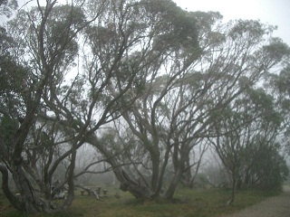
View from our window at Diana Lodge, Falls Creek
I just about choked on my calcium tablet which was not a good start to the day. My nose was running, too. Unwell? I hoped not.

Breakfast was another good spread. I opted for scrambled eggs and tomato again and also had some yoghurt to make up for the calcium tablet. We also collected our lunch. A number of people had observed that they could not eat all their lunch as the rolls were far too big. I have to agree. I didn't manage to finish my rolls on any of the days that Lisa supplied them.

Back in our room we finished packing and carried our bags up stairs (two flights) to be loaded in the trailer for the trip to Dinner Plain.

We were all on the bus ready to go by 8 o'clock. It looked like a perfect day for hiking. Trevor and I both opted for long pants, long sleeved shirts and gaiters and were thankful that we did. Those pesty March flies did not have a feed at our expense and the grass and other vegetation didn't attack our legs with gay abandon. I think we will be wearing longs over the next two days for same reasons: grass and insect attacks.

Pretty Valley Pondage
We trundled out to Pretty Valley and started our walking at the Pretty Valley Pondage. The whole group was doing the first bit of the walk which took us along the Fainter Fire Trail until it met a track that took us down to the Australian Alps Walking Track. The fire trail was a steady climb. As we crested each rise we were confronted with yet another. It just kept on going up.

At the fire trail junction those who opted for the easy day went off with Maria while eleven of us trooped off with Phil, headed for Hotham. The Hotham group had been warned that they would cover just over 19km for the day and have a height gain of 1020m and a descent of 800m Definitely a challenge for the legs.

The day grew warmer as we proceeded with just the odd fluffy white cloud.

On reaching the junction with the Australian Alps Walking Track we headed for Hotham. We were to follow the track all the way to the village. Initially the country was very flat. Someone described it as a giant football field. It probably would not have been too good for football as it was covered in a range of plants causing the surface to be quite uneven.


Taking a break. Trevor 2nd from left
We did see a couple of Brumbies at a distance ... so we could tick that off.

The array of plants was impressive and the many tiny flowers a delight. I did take photos of a number of them which I will include in due course.


View over the ranges
As we neared Cobungra Valley the track dropped sharply. It was about this time that Phil gave us a lesson in bush tucker. He introduced us to a shrub growing along the path and told us to taste it. He said that we should chew it but could split out the pulp afterwards. The plant turned out to be the native pepper bush and the leaves were firey. Would we trust Phil again? Probably not.


Beware th native pepper bush
Later Phil suggested that the flower of the bluebell was quite edible. While he ate one no one else did.

The species of trees changed as we descended into the Cobungra Valley. I'm not sure which of the eucalyptus became prevalent. It certainly was not the snow gum.

The understory was thick and often intruded on the path, sometimes crossing it, which meant that we had to push our way through.
Fighting our way through the grass and plant invading the path
In order to encourage people to visit the area one of the groups overseeing the area have installed sleeping platforms just above the Cobungra River. To date, three have been installed.


Sleeping patforms
Just before we reached the Cobungra River, river who could well ask, we came to the toilet. Toilets have been provided at quite a number of places in the alpine region and they are certainly a welcome sight. The ones we had previously come across all had a supply of toilet paper. The one at Cobungra had once had paper but, alas, no more. The supply had been exhausted. Just as well we had come prepared!

The river was not much more than a babbling brook but still a pleasant sight. The bed was strewn with large stones and small rocks which meant that there were lots of spots where the water fell trinkling as is flowed downstream.

We crossed it via a bridge and then walked across a flat with tallish grass that intruded on the narrow footpath towards Dibbins Hut and our designated lunch spot. We were not alone as there was a trio of boys there before us. We settled down for lunch spread along the back of the hut, as that was where the limited shade was, or down by the river.
 
Dibbins Hut
Cooling off in the shade beside the river
Phil and Alec, the youngster of the group at a mere 13 years old, spent their break building a dam in the creek ... moving some of the stones around to form a pool.

Finally we packed up and set off for the climb up to Swindlers Spur. The heat at the start of the climb was sapping. The constant up hill drag in the heat was challenging. There were occasional delightful views when there was a break in the trees. As we neared the top we started to pick up a most welcome breeze. The group became quite strung out as each of us set our own pace on the climb and took rests whenever suitable shade was available. It took about 45 minutes to reach the top of the climb. Unfortuantely my phone app thought that I had only climbed 8m. I know it was much more. I'll check out the stats when I get home to get a better elevation gain figure. According to the map the climb was around 340m. [The climb was at least 344m]

Alec beside the track with a profusion of flowers
Once on the spur the walking became easier. The occasional breeze was wonderful and helped to keep me cool. Unfortunately, the climbing was not over. There were further uphill sections on the spur and later on, too.
Hotham in the distance
When I reached Derrick Hut, quite a new addition to the alpine huts as it had been built around 2004, I waited for a while. There was little external shade. The trio of boys we had met at Dibbens Hut arrived and went into the hut. I cannot recall Phil telling us to stop at the hut so I continued on and was joined by John, one of our group. We continued along the Australian Alps Walking Track, following the poles. The track was quite hard to walk on as it was stoney or rocky. The rocky bits often had shale standing upright. A hard walking surface. In addition, the track is quite narrow and sometimes worn quite deep making it more challenging than other paths we had used.

Once we got within the Hotham Ski Area our climbing did not stop. We eventually ended up on a 4WD track which was rocky and rough and continued to climb. The heat coming up from the track was another problem to contend with.

Still more terrain to cover
When John and I finally arrived at the end of the walk, the zero pole, we had beaten the bus and there was no shade to speak of. We figured that we should be able to grab a cold drink in Hotham and headed into the village. The place was dead with almost nothing open. No cold drinks were available except in a vending machine and we did not have change.

John and I had hoped that the bus would drive through the village on the way to the zero point. Alas that did not happen. Eventually Phil phoned me. Fortunately I had turned flight mode off so I was able to get the call. The bus duly picked us up in downtown Hotham.

I had walked some 18.8km today with an elevation gain of at least 921m and a fall of 738m. It was hot making the climb quite tough. All in all a very demanding walk.

We were staying out at Dinner Plain, some 13kms out of Hotham. Dinner Plains is a picturesque village with quaint buildings. It, too, was pretty dead. Rundell's, where we were staying is open year round and we seemed to be the only guests. After showering we headed out to explore the village and concluded that even things that should have been open were closed. There was a pizza joint and the pub operating after 5pm. We were not concerned as we were eating at Rundell's and what a wonderful meal they served.

Stuffed to the gills well watered we headed off to bed.

Great Alpine Walk: day 3

The morning was clear and sunny. A good omen. Today offered a number of longer walks so the good weather was most welcome.
Breakfast was served at 7:30am again. This morning I opted for scrambled eggs and tomatoes with orange juice, toast and coffee. Trevor had cereal followed by scrambled eggs and bacon.

The bus departed at 8:30am and we trundled out over the dam wall and around the edge of Rocky Valley Storage to Langfords Gap where the walked commenced. Today we followed the Langfords East Aqueduct.

One of the glorious views near the start of today's walk

We came across some delightful vistas (and I hope the photos do them justice) as well as some glorious birds and flora. The first birds of note were Gang Gang Cockatoos. These were followed by Scarlet Robins. There were other birds and at this stage I don't know what they were.

Photographing the scenery. Note the "ghost" trees beside the path. Trevor is front and centre in the white hat.
The group broke up very quickly with some in the front, a middle group and a number of stragglers. This really slowed down progress as we kept needing to stop for the back markers to catch up.

We only managed just on 3km an hour for the first 8km. Considering that the up slopes were generally very gentle as were the downs this was a very slow speed indeed.

By the time we arrived at Fitzgerald's Hut it was after 11:30 and it was decided that this would be our lunch stop.

Trevor lunching at Fitzgerald's Hut
Fitzgerald's Hut has been restored after it was accidentally burnt by a school group. The current building gives a good idea of the type of huts that were used by the cattlemen during the summer when their cattle were up on the high plains. I suspect that my father stayed in one of these huts when he was helping with the muster at the end of summer. He talked about going up to the high country by horse. I wish that I had paid more attention to his tales.


Note the corral visible in the middle of this photo
Fitzgerald's Hut sits in a clearing in a field of grass and flowers. Huge gums form a ring around the clearing. There was a collapsed corral adjacent to the hut which would have been used to hold the stockmen's horses in days past. Today it would not hold anything. Repairs would definitely be needed.


Leaving Fitzgerald's Hut: meadow and views across the ranges
On leaving Fitzgerald's Hut we headed across the meadows and were to link up with the Australian Alps Walking Track at a place known as "The Park". From their we should have followed the Australian Alps Walking Track until we picked up the track to Edmondson's Hut. By the way, lunch was supposed to be at Edmondson's Hut! Our guide was looking for a particular marked pole, 740, I  think. We did see 739 but were then sent along a track which later proved to be the Washbed Creek Track which took us back to Rocky Valley Storage! Oops!!! The 740 marker would have been on the Australian Alps Walking Track and this track was clearly marked with yellow triangles yet we were sent along another track. I was not at all happy. Actually, I was pretty pissed off.

Initially it was decided that we could walk around the road circling the dam to the track up to the Roper Lookout. Part way along this walk we were picked up by our bus as it had been decided that walking along the road was too risky.

We were driven to the start of the Roper Lookout trail and proceeded to climb to the lookout which provided great views over Falls Creek.

Falls Creek from Roper Lookout
Back at the bus we were offered a number of options. We could walk back to the Village and the lodge; we could be dropped in the village or at the lodge or we could do the Frying Pan Spur walk from Howman Gap back to the village. Most of the group opted to be dropped in the Village. Ian and I opted for the walk. The bus trundled through Falls Creek and headed out to Howman Gap but Phil could not locate the start of the walk. It was decided to return to the Village, drop off everyone who was not doing the walk and then do the walk from above the Village out to Howman Gap. So we dropped most of the people in the village.

Phil, Ian and I were dropped at the spot were we had started the last part of the walk yesterday. Up on the ridge Ian opted to follow the track we had walked along yesterday as he had dropped his phone and was still looking for it. Phil and I continued on. The first part was relatively flat as we headed out on the spur. So far so good.

View from the top of Fryingpan Spur

Once the ground fell away it was not so straightforward. Picking up the track down was not obvious. There was a line of poles which were going in the right direction and we followed them until they ran out. From there on it was challenging picking up the track. The insect life was obvious. Lots of spinders and other bugs as well as mozzies. At least the flies were absent. It took us about 45 minutes to do the descent. We heard one of the "ghost" gums fall during our walk. An eerie crash in the forest. There were a heap of fallen trees to negotiate: over or under.

In many ways the final walk of the day was the most fun. The terrain was rough and we needed to watch our feet as well as the many hazards in the surrounding bush. While there was evidence of fires through the area there was significant regrowth and, near the bottom, trees that had survived the fire. I suspect that we were seeing a different species as these were much more robust than the snow gums which stand today as ghosts throughout the Falls Creek area.

Phil pointed out some of the plants which were unusual. He also demonstrated the action of the trigger plant. This is a small purple flower that attracts insects. When the insect starts to feed on its nectar a trigger is tripped and it snaps out and leaves pollen on the insects back. The flower uses the insect to transport the pollen to other flowers. It was very neat.

The track was quite challenging to find. It was fairly tough going down hill as there was a lot of litter underfoot. We concluded that it would not be suitable attempting to do the walk in reverse as had originally been planned.

Phil called Maria when we had about 50m to descend and the bus was indeed a welcome sight as we emerged onto the road.

All up Trevor did 20kms today and I did and additional 3.5km. My elevation gain was 544m and the loss was 784m..

Back at the lodge I showered and changed.

There were nibbles at 6:30 and Trevor and I joined the rest of the group in the lounge.

Lisa served another very nice dinner (apart from the coriander in the salad which Trevor did not appreciate).

Sunday, 20 January 2013

Great Alpine Walk: day 2

This was the first real day of our walk. Yesterday was just a travel followed by a stretch.  Today was going to be the real thing.
Breakfast was scheduled for 7:30am with 8:30 as the departure time. We had two alarms set for 6:30am and both of us beat them up. We were obviously raring to go.

We showered, dressed (except for our footwear as outside shoes/boots are not get worn inside the lodge), organised our packs as far as possible without lunch and snacks which were to be collected with breakfast.

The weather looked OK. There was some cloud but a fair amount of blue sky.

The overnight temperature had got down below zero so the day promised us a cool start.

We were a couple of minutes early for breakfast but were not the first! Lunch was the first order of the day and we collected our cute and practical insulated lunch sacks and proceeded to pack our lunch. Last night we had to give our lunch order. Just as well Trevor remembered what we had ordered: plain salad. The rolls looked great. They were crunchy multigrain rolls and, when we stopped for lunch, delicious. There was a bun for a snack, fruit and a juice. With the lunch bag packed it was time to grab the real snacks.  I filled by snack bag with dried fruit and nuts.

Breakfast was ready and we headed for the various tables that held the self serve component. With a glass of orange juice and museli with fresh fruit salad followed by a piece of toast and coffee I was set for the day. Lisa also provided a cooked breakfast however I decided that the museli was quite sufficient. Tomorrow I'll try the scrambled eggs with tomatoes.

When I went to put my boots on as we were leaving the lodge I discovered that I had only one of my gaiters. I rushed back to our room and could not see the missing one so spent the day with one gaiter on and one leg gaiterless. When we got back to our rooms after the walk there it was sitting on the towel rack in the bathroom. Don't ask!!!

With everyone on the bus we headed out of the village of Falls Creek. By 8:30 the weather had closed in and low cloud obscured the surround peaks. When we got to the dam wall of the Rocky Valley Storage there were ripples across the surface as well as mist rising from the surface. At one point there were bubbles coming up from below. All very mysterious. 

Mist rising from the surface of the Rocky Valley Storage. There were waves, too
We continued on around Rocky Valley Storage and were finally deposited near the Langford West Aqueduct. This was where our hike for the day began.

Following the trail alongside the aqueduct we had views of the misty peaks and valleys. The ghosts of the trees which had been killed by the last bushfire through this area merged with the whiteness of the mist. The walk was relatively easy as the track was fairly flat with just a gentle incline. We eventually got to the track to Cope Hut, the first of the huts we will visit on this trip.

Just before we reached Cope Hut we spied a welcome sight - a toilet. It was used by quite a few of our party while we were at the hut. We all crowded into the hut as the members of the party arrived. It was pleasant being inside out of the chill of the day.


Trevor inside Cope Hut

Back outside we retraced our steps until we picked up the track to our next hut: the Wallace Hut, which is the oldest surviving cattleman's hut in Victoria. Along the way we had come across some abandoned clothing which seems to have belonged to a school boy. No doubt his parents were probably annoyed that he had managed to lose bits of his school attire.

Once again we were delighted by an array of alpine flora showing us their attributes. While January is after the main flush of alpine flora there were still plenty of species in flower displaying their blooms for us to enjoy.

At Wallace Hut we were not alone. There was quite a sizable group of people in the area when we arrived. They quickly left the hut to us. The hut has been maintained across the years and in the past year repairs have been made to the entrance doorway and around the hut. Still, it was great to go inside and see the environment in which the cattlemen survived during the summer.

Wallace Hut
There were some magnificent old trees in the area around Wallace's Hut. Huge specimens which probably took centuries to reach their current size. They were shrouded in mist.


On leaving Wallace's Hut we made our way down to the banks of Rocky Valley Storage. This involved trekking across meadows covered in a variety of alpine flora which included heaths and grasses both of which made the traverse challenging. once down on the shore of the dam we were faced with rivulets which slowed our progress as we attempted to find crossing points that didn't end up with us sinking into mud.
Finally we got to a point where we were traversing the slopes around Rocky Valley Storage. We walked through meadows with a wonderful array of flora. There was quite an array of plants in flower to delight even the most unobservant of walkers.

Trevor eating his lunch

We stopped for lunch in a meadow on the western end of the Storage. There were plenty of large rocks to sit on and a number of the party look advantage of the improved weather, the clouds had finally lifted and the sun had come out, to lie back and rest on the meadow.

Some of our group enjoying the lunch break and the sunshine
After lunch we continued to circumnavigate Rocky Valley Storage until we reached the chairlift runs up the slopes to the ridges above the dam. We headed up the slope. It was quite challenging. Not only the pitch of the slope but also the plant material underfoot. There was a lot of lumpy grasses which made footing uncertain and added considerable strain to the climb. At the top there was a refuge which was a welcome respite from the lazy, chilly breeze.

Unfortunately, we could not stay in our sanctuary forever and once the stragglers arrived and had a chance to catch their breath it was off again to walk back to Falls Creek Village.

Phil told us that we were only 45 minutes away. Well, we were but not to the Village. It took considerably more than 45 minutes to get back. To start with Phil suggested that it was just a bit of a climb and then all downhill. If only! To get to the ridgeline that we were to walk along before heading down was quite a climb. I'll check my Runtastic statistics and confirm the climb when I get a chance. It was not just a Sunday afternoon stroll.

Finally we started down. We followed a narrow track which eventually ended in a stepped path. The steps were challenging and required close attention to where feet were placed otherwise considerable damage could have resulted to body and limbs.

We finally made it back to the Village and our lodge. A very welcome sight indeed.

Trevor and I took advantage of the spa at our lodge. It eased the tired legs.

How far had we walked? Today we walked 18.8km.

[21 January update] The elevation gain for the day was 509m with a loss of 631m.

Dinner tonight was not included so Trevor and I went off to the pub where we had a very pleasant meal. We were the only patrons to dine there. The rest of our party had decided to eat at Max's - a cafe style eatery and the only other place serving meals in Falls Creek after 5pm.

Great Alpine Walk: day 1

This is the first of 7 or so posts covering the Great Alpine Walk that Trevor and I undertook with Auswalks in January 2013.

There were 11 other walkers in the group:

  • John from PNG
  • Joan and Maria Teresa, a couple from Barcelona
  • Trish from Perth
  • Peter, Ian and Sam from Queensland
  • Marie-Louise and her son Alec and Anne from Sydney
  • Alison from just over the hill from us in Canberra.

Our guides were Phil and Marie.

Yes, we had more than the odd Marie/Maria.

Here is the first installment. Oh, I will get around to tarting up the posts however I am a bit restricted with what is available and I thought it best to start to post what I have done to date. There will be photos in the following day posts.

Great Alpine Walk: Day 1

Trevor decided to wake me up at 6:20am .... I had my phone set to go off at 6:30 so the extra 10 minutes was not welcome. I turned over and went back to sleep until my phone sprung into life.

Up and into the shower.

After sorting out my bag and what was not going on the walk I went and got my breakfast: museli and a cup of tea. Trevor had already had his breakfast and Helen, my niece who had arrived about 10pm for a bed at her mother's, was also up.

Helen, accompanied by Jen, drove us into the city and dropped up in Spencer Street. We had a good run through and arrived before 8:30 which meant that we could have a cup of coffee, the first of many for the day, before going to our pickup spot.

What time were we being picked up? Our documents had 9:00am on page 1 and over the page it said 9:20am. We arrived at the Alto on Bourke Street before 9:00 and joined an ever growing group of hikers as most had opted for the pickup at the Alto. This gave us a chance to meet some of our fellow hikers.

The Aus Walks bus arrived across from the Alto just before 9:20 and we trundled across the road with bags and packs. Being a Sunday there was almost no traffic at that hour so it was easy to do the crossing. As our bags were being loaded we met of guides: Phil and Maria. We had two further stops before heading for the Hume Highway and the north.

We had a toilet and coffee stop about an hour and 15 minutes after leaving the airport. The lunch stop was at Milawa and a further stop at Mount Beauty before doing the climb to Falls Creek.

The day had started grey and got progressively heavier. By the time we stopped for lunch it had started raining, lightly admittedly, but still rain. It continued to rain as Phil negotiated the winding road up to Falls Creeek, our home for three nights.

After checking in and checking out our accommodation at Diana Alpine Lodge we headed off for a walking tour of the village. This was important as we need to organise our own dinner tomorrow night and needed to check out the limited oprtions available to us during the off season here in a skiing resort. At least the rain had stopped although the grass was damp and we did traverse a number of grassed areas.

At 7 o'clock the group met in the bar for pre-dinner nibbles and drinks.

Dinner was served in our Lodge and was fine except for some coriander in Trevor's main.

After a briefing for tomorrows program it was time to retire for the night.

Sunday, 23 December 2012

Camel Back Trail, Camels Hump and beyond

On Saturday 22 December Trevor, Michael and I did one of the longer walks available in the Tidbinbilla Nature Reserve: the Camel Back Trail out to Camels Hump and then on towards the Pierce Trig.

Michael arrived shortly before 8am. We had decided to get away early as the forecast was for a hot day and we were hoping to beat some of the heat.

The first stop was Brothers Oven to get some breakfast for Michael (an egg and bacon roll) and coffees all round. This was takeaway so we were quickly back on the road and heading out towards Tharwa and the Tidbinbilla Nature Reserve. We were early enough to miss most of the cyclists and only came across three on the narrow, winding road between Tharwa and entrance to Tidbinbilla.

A stop at the visitor centre to get Trevor's car added to my park entrance pass as I had not been able to determine how it could be done online. This provided a last toilet stop, too.

It took us a little longer than it should have to reach the carpark at the start of the walk as we did the complete circuit of the ring road as there is no specific signage for the Camel Back Trail from the ring road and you need to be aware that you need to take Mountain Creek Road to reach the start of the trail. One the second circuit we picked it up and finally reached the carpark.

What a lot of wildlife there was this morning. Yes, I know that it is a nature reserve however there were animals wandering across the road with complete abandon. The 35 kph speed was certainly justified.

At the start of the trail is a log book and we duly signed in and noted that there was another pair of walkers on their way to Camels Hump. That accounted for the vehicle in the carpark.

Our starting elevation was 908m.

The first bit of the trail, some 200m, took us along a path that had logs placed at regular intervals to prevent erosion. We were soon at the Camel Back Fire Trail and the long, hard slog up the trail. According to my stats we climbed 182m in that first kilometre and somehow managed to lose 7m. Yes, there was the odd dip as well as the upwards slog.

I spotted a snake on this section. It took a couple of goes to alert Michael to the presence of the reptile which was slithering across the trail just ahead of where we were. We stopped and let him go and he disappeared into some rocks in the bank at the edge of the trail. Michael thought that the snake was about a metre long. I won't argue with that. I certainly was not going to stop a red belly black to measure him! 

The trail leveled out in the second kilometer with only 47m gained. The third kilometer was a little more up and down with a gain of 22m but a loss of 44m. The fourth kilometer saw us slog up a further 114m with enough down bits to add up to a loss of 21m. Yes, at times it was a bit like a roller coaster. The fifth km had a rise of 105m and a loss of 14m. By this stage we had gained some 470m with a loss of 86m - a net gain in elevation of 384m. The final bit of the trail up to the Camel Back sign just below Camels Hump was another fairly step climb as we trudged up to 1343m a further gain of some 51m only there were ups and downs in this section, too.

Michael had spotted the other walkers who had left ahead of us as they descended Camels Hump as we approached the Camel Back sign. There could have been hundreds of people on the trail however the trees and other shrubbery along the trail effectively blocks out the trail except for the stretch you are currently on. 

At this point, at the Camel Back sign,  my run stats seem to have gone a bit haywire as the climb up to Camels Hump, some 78m above, seems to be missing. Michael and I did the ascent of Camels Hump which proved to be quite steep with no formal track but a whole range of possible tracks which were generally rough and required quite a deal of scrambling on the way up and a great deal of care on the descent. Fortunately there were quite a few small trees crowding our route as they provided handgrips and helped to steady us, particularly on the way down.

Trevor had been trailing behind Michael and me. We kept him in view, his white hat making him easy to pick up against the greens and browns, and took advantage of stops in shaded spots so that we were never too far ahead of him. He climbed slower than we did but his speed was pretty consistent as he plodded up the trail. He left Trevor down below when we did the ascent of Camels Hump. This allowed me to leave my pack behind and we too everything out of Michael's except the bare essentials: emergency kit, water and map.

Back down from the hump we headed on towards Pierce Trig, some 2km further on. About 500m before the Trig we came to a fire trail that headed sharply down hill. We shopped at this junction for lunch. The cup of tea was most welcome even if the water was not freshly boiled but from the thermos.

We eyed off the trail that would take us on to pierce Trig and it, too, seemed to be heading down and we decided to turn around because every down section would require us to climb that same section on the return.

The ups and down on the return were a little surprising. We had not recognised just how much down bits there had been on the way out. These became up sections on the way back. The elevation gains and losses by km on the return were:
1: 35m and 31m
2: 49m and 44m
3: 28m and 76m - the first real dint in the elevation that we had gained on the way out
4: 29m and 119m
5: 34m and 120m
6: 44m and 50m
7: 0m and 95m
8 (actually only .6km): 0m and 68m

There were some seriously step section on the return where we had to be careful of our footing as the surface on the trail was quite loose.

I was flagging on the way back and it was not until I got home that I realised that I had not drunk nearly enough water. This was my first outing with the water bladder and I had no idea how much I had consumed until I took the bladder out of the pack and discovered that I had only drunk about 1/2l plus a small cup of tea while out on the trail ... more than 5 hours all up in quite hot conditions. Definitely not enough. I had been conscious of not over hydrating and went the other way. Oops. I need to be aware of this the next time I'm out hiking.

Trevor had done well. While he was slower than Michael and I on the outward part of teh hike he did maintain his pace and he was never too far in our rear. He maintained a good pace on the return journey. Overall he was really pleased with how well he had gone.

It had been a hot day with the temperature nudging up into the mid 30s. The heat reflected up from the surface of the trail added to temperature. Patches of shade along the trail provided welcome relief as did the breeze when it came.

All in all, this had been a tough but enjoyable outing.

Friday, 21 December 2012

Helpful phone app

I have finally got around to loading an app onto my phone to track some of my walks. I picked the Runtastic app. The basic version is free. You get voice feedback for the first 2km of the "workout". To get voice feedback beyond the 2km mark requires the Pro version for which there is a charge. I'll make sure that I am happy with Runtastic first before shelling out money on the Pro version ... although it does have some useful features such as being able to add images during your workout ... tempting when climbing mountains!

Yesterday (Thursday 20 December) was the first trial. I did the walk home from Cooleman Court via the Stanhope Highway. Not only did I get an accurate distance record but also details of height gained and lost across. The details of the activity, you can nominate whether walking, running or any one of about 30 other forms of activity you are doing, can be stored and referenced later. It was good to see the profile across the route I took although the pace did look a little lumpy. Still, overall it was great to see the statistics.
  • Distance: 6.09km
  • Elevation (gain/loss): 164m / 129m

In the evening I walked to the end of Marconi Crescent, one of my regular night walks, and managed to loose the data before it was uploaded. Bother!

Not to be defeated, I did a shorter walk to work out what went wrong and this time managed to save and upload the stats.

This morning (Friday 21 December - even if the uploaded stats is insisting that the date is still the 20th ... I need to work out how to set the time zone ... which I finally managed to do so that activities are now recorded against the correct day) I went out with Trevor on his morning Inkster Street walk so that he could get an accurate measure of the distance he walks each morning. It turned out that the circuit was exactly 5km.
  • Distance: 5.00km
  • Elevation (gain/loss): 63m / 63m 
 Trevor regularly rides from home around Lake Tuggeranong. I've walked and run this circuit, too. Today I measured the distance:
  • Distance: 12.64km
  • Elevation (gain/loss): 65m / 65m
This was a longish walk in the heat of the day.

I'll add statistics from other regular walks as I do them.

Thursday, 20 December 2012

The Mount Taylor climbers Christmas breakfast

Last year I discovered that there was an annual gathering of people who climb Mt. Taylor. Of course, you have to climb the mountain to attend as the gathering is at the top. The only draw back is the early hour: 6am. Signs had been posted on the eastern and south eastern access points to the Mt Taylor Nature Reserve. I couldn't resist the opportunity to meet some of the other climbers so I attended the 2011 gathering even though I had a number of other activities scheduled from 7am onwards on that day. The surprising thing was that there were people at the function who I had known from my previous lives - some I had not seen for many years. It was good to catch up and also to meet the other "regulars" who stomp (or run, yes run) up and down the mountain that dominates my back yard.

This year I had not seen any notification of a pre Christmas gathering on the mountain top until well into December with the date set for Thursday 20 December. This year both Trevor and I decided to attend. Trevor has been plodding up and down Mt Taylor on a regular basis for a while now so was very much entitled to attend.

The invitation suggested champagne and strawberries however we opted for coffee. It was a good chance to check out my swish new thermos - the one that will be accompanying us on our upcoming walks. Yes, it did work! The coffee remained hot and it was easy to pour from it.

Trevor generally drives to the base of the mountain while I tend to walk. The walk takes almost 30 minutes. Today I opted to join Trevor in the car. We parked just off Colquhoun St and entered the Reserve on the south western side. This gives access to "my" track up the mountain. I'll have to get some photos to show this route. It meanders across a meadow and across a generally dry creek bed before reaching the Western Powerline fire trail. The route turns up the fire trail until you reach the highest point and then you turn off the first trail across a meadow before hitting the first of the real climbs. This track is unformed and provides a real workout for your stabilisers.

This morning, when we reached the Western Powerline fire trail we were delighted to see a large mob of kangaroos spread across the meadows on either side of the trail as well as occupying the trail itself. They were a bit flighty and hopped way as we trudged up the track.

It was a very pleasant morning. The temperature was warm enough for t-shirt only and a slight warmish breeze was not a problem.

My track is not a commonly used one although it is surprising just how often I have met people using it as I am going up or down. On some of the other trails up the mountain you would be surprised not to come across other climbers no matter when you are using them. This is not the case with the route from Colquhoun Street. The only person we encountered going up or down was a runner actually using the Western Powerline trail and not climbing the mountain.

When we arrived at the top just on 6am there were already a number of people there enjoying the views and the delights of the clear early morning light. The last of the dawn pinkness was fading from the scattered clouds and the citty spread out below us like a huge forest with just the odd scar (Woden town centre, the hospital complex and civic as well as the major arterial roads) announcing that this really is an urban area. Most of the buildings are camouflaged by the mature trees they are such a feature of Canberra's suburban landscape.

People kept on arriving at the top of the mountain by a variety of the many available routes. Some came singly, others in pairs and a few groups had also made the climb. As each new person arrived there were introductions and, finally, someone arrived with sticky labels so that we could all name ourselves which meant that introductions became much easier.

The crowd started to thin around 7am and we headed down leaving a couple of stragglers behind.

All in all it was a pleasant way to start the day even if a couple of hours more sleep would have been advantageous.