Following the walk we were saddened to hear of the fires that burnt through the area in which we had just walked. The storm that had dogged our final full day of walking on day 6 appear to have ignited the fire. A dry storm is a significant hazard when the vegetation has dried off and dry fuel has built up on the ground. The landscape through much of the areas we walked will have been transformed, yet again, by fire.
This post is intended to provide overall impressions of the trip as well as the organisation surrounding it.
We had booked this trip with Auswalks, a company operating out of Victoria and headed by Phil and Monica Coleman. The booking had been done online and payments were straightforward. In most cases the information provided about the trip was sufficient for our needs. I did have a couple of questions and these were promptly answered.
When we received our package of documents, maps, map case and book it was only one set. Whether you are a couple or two singles sharing may be OK however there was no discount for getting only one set. I'm pleased that Trevor and I didn't have to share a lunch bag!
The trip information was comprehensive. The only issue was that the pickup time was shown on both the first and second pages and was different. By the time I realised that there were two times given it was too late to check so we fronted up at the earlier time and, of course, it was actually the later time that was used.
I did have a couple of questions and these were answered promptly.
Having a list of the participants in the doco was great as it made it easier to identify each other as we gathered and mingled.
Our guides, Phil and Marie, duly turned up in Bourke Street and the milling crowd trooped over the road and we presented ourselves and our bags to them. They were both very welcoming, greeting previous clients warmly.
There were regular stops when travelling allowing toilet trips and acqisition of refreshments. It was also OK to eat and drink on the bus. Adequate time was allowed for us to do whatever was necessary during the stops without making them unnecessarily long.
Phil and Marie provided background information as we passed through areas which helped to fill in the time. Sitting on a bus can be boring if you are just beetling along a multi-lane highway so it was good to turn off the highway onto the country roads which took us through to Falls Creek.
The trip notes gave information about the accommodation we would be using. It contained information about the hosts, too, which was a nice touch.
The accommodation and both Falls Creek and Dinner Plain was very comfortable and the facilities more than adequate. The spa was a very welcome offering at our Falls Creek lodge and Trevor and I took advantage of it on day 2.
Lisa, the host at Diana Alpine Lodge in Falls Creek, was very accomadating and the food she served us for the two dinners and each breakfast along with the lunch rolls was excellent. Trevor didn't appreciate the corriander in one of the dishes but that happens.
The dinner we were served at Rundell's, our Dinner Plain accommodation, was outstanding as were the breakfasts. I think that we were all beginning to wonder if we would return home after a weeks walking a little heavier than we started!
There had been a change in where we stayed in Harrietville. This was beyond the control of Auswalks as they had apparently booked the accommodation 12 months in advance only to to flicked at the last minute. The rooms at the Snowline Hotel sufficed as we were tired and a comfortable bed was all that really mattered. I'm not sure when the room we had had been last cleaned. It had been occupied by a mouse between being cleaned and when we arrived. I dealt with that and hoped that the little rotter did not visit again during our stay. There was only one chair in the room which was a bit odd. There was seating outside the rooms under the verandah which was a problem as it meant that people sat outside talking loudly when the rest of us were trying to sleep.
The food at the Snowline Hotel was excellent. Both the dinner and breakfast were very well done.
The walking
My comments are coloured by my Flinders Ranges walk experience so readers need to take this into account.
Flexibilty is fine and generally necessary to take into account weather and other on ground conditions as well as the individuals in the group however it would generally be expected that the listed offerings for the day would be catered for. This was not the case on day 3 when a whole section of the plaaned days walk simply didn't happen as a track was missed and by the time it was determined that it had been missed we were ks away from where we should have been to take that track. The frustrating thing was that I had thought that we should have taken the track that proved to be the correct one but the guides notes were insufficiently clear which lead to the error.
Both guides had notes that they followed. It was apparent that some things had changed since the notes were prepared and this was the cause of some problems on at least two occassions (days 3 and 5).
Trevor felt that quite a bit of the walking was through similar country. To an extent that was true however it was an alpine walking holidays so it was not unreasonable that we walked through alpine areas on most days with a degree of similarity from one area to another. There was definitely enough change in the geology and flora to make each walk interesting.
Given that the holiday had been chosen as a preparation for the Coast to Coast walk which we will be doing later this year I believe that it met its objective. I didn't realise how physically tired I was until I just about went to sleep while eating dinner on the last night.
All up I had walked at least 108km with quite a bit of climbing and descents. Most of this, 100+kms, was done across the middle five days which means that those days averaged a good 20kms a day.
Of the climbs and descents ... I'm not sure which is worse - going up or coming down. Both have their challenges.
Only time will tell whether the Great Alpine Walk was a good preparation for the Coast to Coast walk
Nice touch
Our guides had taken quite a few photos during the week and we were presented with a CD containing over 100 images at breakfast on the final morning. Not only did we get a copy of the photos we were also given a slide show.
Here are photos of our party (as supplied by Auswalks):
... our guides
 |
| Phil |
 |
| Marie |
... and the walkers ... except for Trish who managed to miss the photo sessions ...
 |
| Ian |
 |
| Trevor |
 |
| Maria |
 |
| Joan |
 |
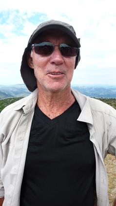
| John |
 |
| Lorraine |
 |
| Alec |
 |
| Peter |
 |
| Sam |
 |
| Anne |
 |
| Marie |
 |
| Alison |
Would I consider taking another walk with Auswalks? Yes.
My Runtastic phone app got a good workout during the week. I worked out on day 2 that I needed to set the phone to flight mode to conserve battery power on long day walks. I found the prompt at the completion of each k useful. A couple of other people in the party were impressed enough to get Runtastic, too. Over the course of the week it was not unusual to have people ask how far we had gone.
I wasn't the only one with a gizmo. Joan had an altitude metre, well he is a mountain climber after all, which was useful on day 6 when we were descending from Mt Feathertop down to Harrietville.
I think that Trevor thought that much of the country we walked through was the same. To an extent he was right however there was always something different to see and there was variations between each of the trails we walked.
I also suspect that I was more prepared for sameness having done quite a few walks in Tidbinbilla. This will always be a glass half full/empty situation. Yes, there were similarities but there were also differences and it is the differences that always have the ability to surprise.
We had a great week which allowed us to check out our equipment, clothes and current level of preparedness for a strenuous period of walking. It gave us pause to think about what sort of luggage we should take to England when we do the Coast to Coast walk and how much clothing is needed.
The water bladders were definitely a good investment. Being able to drink without having to stop and de-pack or having to carry a bottle in your hand all the time was hugely beneficial.
I'm sure that there are other things that I meant to say which have slipped my mind.
I will do a flora post when I get a chance. We have quite an array of photos which will need to be sorted through before I attempt to put them in a post.


