Wednesday, 30 October 2013

Cooleman Court to Kambah via the Stanhope Highway

One of my frequent walks is from Cooleman Court in the heart of Weston Creek home to Kambah. While I have experimented with routes between these points the one which I enjoy the most is the one that takes me past the Chapman shops and along the Stanhope Highway.

[Note: The Stanhope Highway is the wide fire trail that skirts the cut-off drain around the base of Cooleman Ridge and Mt Arawang. The Stanhope highway is not its official name but is a term provided by a local wag.]

From Cooleman Court home is a shade over 6km. If you were to finish at the Kambah Village instead you would probably add about .5km to that distance.


Starting from the southern entrance/exit of Cooleman Court head south towards Hindmarsh Drive. You need to cross Parkinson Street, one of the very few road crossing on this walk.
Parkinson Street
Once across Parkinson Street head towards Hindmarsh Drive and pass through the underpass.

Follow the path through a open space keeping to the path running on the right hand side of the open space.
When you finally run out of fences turn right into a cul de sac.
Keep to the left hand side of the roads until you reach the other side and enter a path heading down towards Fremantle Drive.
This path leads down to Fremantle Drive
 Go through the Fremantle Drive underpass
Continue ahead along a path that runs between the Canberra College Weston Campus and a fence which eventually is taken over by a hedge.
As you near the Stirling Ovals you will completed 1 km of the walk. At this point you will be confronted with a muddle of paths.
Continue until the path you are on intersects with a path running along the edge of the ovals/netball courts. Turn left.
Follow the path until it makes a sharp turn to the left.
Veer off the cement path onto a dirt track leading in a southerly direction through the trees.
The surface of this track is a little uneven. Take care along this section. Tree roots often are exposed and can catch the toe of unwary walkers/runners.

Continue along this dirt track until it meets a cement path. Cross the path and then turn right on the next path you come to.
Follow the cement path until you encounter another underpass on your right.
Go through the underpass. This takes you under Streeton Drive.
You will now have the Chapman Primary School and Pre-School on the left hand side of the path. To the right are the Chapman shops.
The path curves around the Chapman Pre-school

You have now gone 2km. If you want a break there is a bakery that also serves coffee and the Chapman Takeaway as well as an IGA Supermarket.

Back on track, the path goes through a final underpass  taking you under Perry Drive.
Take the path which is almost straight ahead with a slight veer to the left.

This path continues to the left of a series of fences and climbs gradually at first and then more steeply as it nears a series of steps.
If you are not used to climbing remember to take your time on the section between the Perry Drive underpass and the top of the climb. All up you will be gaining 68m in elevation. Take the time to stop, catch your breath and look back down into Weston Creek.

The final set of steps brings you out at a path. Turn right for a few steps and then head up a dirt track under the powerlines and alongside a garden.
You will pass a marker post indicating that you are entering one of the many Canberra nature reserves.
Continue to the left of this post climbing towards the crest.
The main track is covered with loose material and is quite badly rutted. Walkers have forged a track along the right side of the main track. Take this narrower track as it is easier walking.
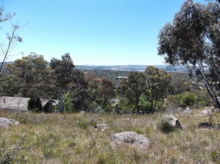
From this track until beyond the crest are wonderful views across the city and the ranges to the west.

The upwards track eventually intersects with a track running around a ridge.
At the point where the upward track intersects with the track you will see a post with a 1 on it. To the left is a post with a box on top with may contain a pamphlet for a guided walk around this section of the reserve
Turn left. This wide track leads down and eventually levels out. A drain will appear between the track and the up slope. While this wide track is actually an access track the sheer size of the track has prompted it to be named "The Stanhope Highway" by a number of the locals.

The views along this section of the track are expansive.
Looking across Chapman towards the Woden town centre
Yes, it really is Woden down there
It is possible to see across to Black Mountain, the flag on the top of Parliament House, the Captain Cook Waterjet when it is operating, Red Hill and much more.

Having recently read about the scared trees in Wanniassa I was intrigued to see this tree and recognise that the scar just below the junctions of its fork is the same as those in Wanniassa. I must keep an eye out for other examples. These trees are older than the national capital.
I love spotting kangaroos on Mt Arawang. In the heat of the day they generally find shade and lie down and rest. Today these roos were happily grazing up near the top of Mt Arawang.

Continue following the track around the base of Mt Arawang and alongside the cut off drain. Just after the 4km mark you will reach a gate with a Park Care sign.
Pass around the gate and continue to follow the track.

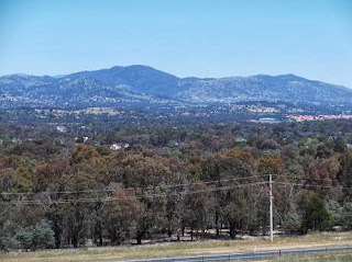
You will now have views of Mt Taylor and the Tuggeranong Valley.
Near the 5km mark you will come across a foot bridge across the cut off drain.
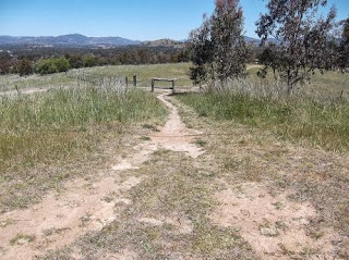
Turn left away from the bridge onto a narrow track leading down to a step through in the fence.
Go through the fence and head up the track heading up the slight rise.
This track eventually heads down towards a fence and another step through.
After passing through the fence turn left and follow the track in a clockwise direction around the edge of the houses until you pass a gate and then come to a cement path.
Turn left onto the path, passing through a pair of posts. Note the blackening on the base of the left hand post caused during the 2003 fires that swept through this area.

Ahead of you is the Kambah Pool Road. Cross the road and then an open grassy area and you will reach houses. You can either wind your way through the houses or go around the edge of the houses. Whichever route you choose you will eventually reach Drakeford Drive and it is then only a short walk to the Kambah Village.

A delightful Canberra walk

Since returning home from the England and Jordan trip I had not done any long walks. OK, I know that my Mt Taylor circuits are just a shade under 10kms but that never seems long. Yesterday I decided to do a leg stretch and after lunching at the National Library, their food is always interesting and nice, I headed for home on foot.

My starting point: the National Library
The National Library sits on the edge of Lake Burley Griffin and I commenced my walk by following the south western shoreline of the lake.

The Teltra Tower on top of Back Mountain is visible from many spots around the lake
Passing under Commonwealth Avenue the National Museum of Australia looms on the Acton Peninsula which juts out into the lake from the far side.


There were quite a few walkers, joggers and people on bikes out and about taking advantage of the pleasant day and the network of paths.

A couple of the walkers I encountered

The Japanese city of Nara is twinned with Canberra and this association is marked by the Canberra Nara Peace Park. This was the site of a candle lighting event on the previous evening with some 2000 candles expected to be lit.


Landscaping in this area has a japanese feel to it.

Once again, there were people out and about


and numerous swans ...


Dotted along the lakeside path are exercise stations. I'm not sure how much use they get as I am yet to see anyone actually using them but they do exist and are intended to encourage people to do a tad more than just walking or running.


As the path wanders around towards Lotus Bay the flag pole on top of Parliament House peaks over and through the trees.


The path tends to be close to the lakeside road and is often shaded by mature trees.


There is the occasional water fountain along the path, generally in areas with BBQ facilities nearby.

One of the water fountains
I decided to follow the route marked as Woden and Tuggeranong rather than Weston Creek so I left the lake edge and walked through the centre of Yarralumla.

Looking back towards the lake and Black Mountain
The route passed the primary school and a number of sporting fields and tennis courts.

I can't remember seeing the Yarralumla tennis courts before
Crossing Adelaide Avenue and the Deakin overpass there are good views down the valley towards Woden and back towards Capital Hill.

Looking south west towards Woden

Looking north east towards Capital Hill. The Parliament House flag pole is just visible
Deakin boasts an array of fitness stations gathered in a single site.


A short distance further along the path the Royal Australian Mint comes into view. A visit to the Mint would be only a short deviation across the ovals that sit in front of the Mint.


The path continues along the edge of Adelaide Avenue which eventually becomes Yarra Glen. It crosses Yarra Glen at the Carruthers Street overpass and the path continues through the leafy suburb of Curtin.

Nearing the junction of Yarra Glen, Yamba Drive and Melrose Drive you come across the Woden Flood Memorial. This memorial commemorates the people who died when a flash flood in this area swept away a number of cars in 1971.


From time to time the Lovett Tower, the tallest building in the Woden Town Centre, pops its top up above the trees and surrounding buildings. Eventually, as I walked along Melrose Drive it could be clearly seen.


Leaving the Woden Town Centre behind I passed under Hindmarsh Drive heading towards the Chifley shops. By this time I had 11km and a stop for a cup of coffee was in order. The Chifley shops have two places where you can grab a coffee and food. A Bite to Eat offers an interesting selection of food from their blackboard menu as well as cakes and a wide range of drinks while the IGA Supermarket offers good coffee, cakes and snacks.

Suitably refreshed I headed up Macfarland Crescent towards Mt Taylor.

Like many of the older, more mature, suburbs Chifley is a target for knock down rebuild. Here is just one of the new houses being built in the suburb. It is certainly much grander than the house it is replacing.


Turning off Macfarland Crescent through a reserve the mass of Mt Taylor looms ahead.


The path climbs steadily until it reaches a step through entrance to the Mt Taylor Nature Reserve.

I'm never quite sure what I will come across inside the park. This walk was no exception. While I was keeping a good eye out for rigglely things I came across a large lizard. It played the "If I don't move you can't see me" game. Unfortunately for it I had seen it. Still, it remained still giving me a chance to take a series of photos.


If anyone can identify my lizard please let me know what it is. It was quite a reasonable size, possibly as big as a Blue Tongue, and had colourful markings on the legs, face and back.

The Golden Everlastings are putting on a lovely display. All the new flowers are providing some glorious yellow splashes across the park.


The flowers will persist right through until later winter next year.

Within our parks mature trees are generally left to nature. Hollows develop over time in many of the eucalyptus trees and while these may look like a problem they are actually an important feature of our bush. Many native birds use these hollows as nesting sites.


An example of a hollow in a tree which is probably being used as a nesting site
 Nearing the park exit I am always taken by the views across the ranges. From the exit gate onwards there are constant views of either the ranges, hills or local "mountains". This presents pleasant vistas and interest to the final couple of kilometres the walk.

A view across to the ranges
All up I walked 16km and enjoyed walking through a number of spots for the first time. While I have often driven along Adelaide Avenue and Yarra Glen you really do get a different perspective when traveling on foot.