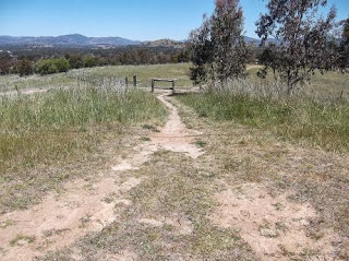
[Note: The Stanhope Highway is the wide fire trail that skirts the cut-off drain around the base of Cooleman Ridge and Mt Arawang. The Stanhope highway is not its official name but is a term provided by a local wag.]
From Cooleman Court home is a shade over 6km. If you were to finish at the Kambah Village instead you would probably add about .5km to that distance.
Starting from the southern entrance/exit of Cooleman Court head south towards Hindmarsh Drive. You need to cross Parkinson Street, one of the very few road crossing on this walk.
 |
| Parkinson Street |
Follow the path through a open space keeping to the path running on the right hand side of the open space.
When you finally run out of fences turn right into a cul de sac.
Keep to the left hand side of the roads until you reach the other side and enter a path heading down towards Fremantle Drive.
 |
| This path leads down to Fremantle Drive |
Continue ahead along a path that runs between the Canberra College Weston Campus and a fence which eventually is taken over by a hedge.
As you near the Stirling Ovals you will completed 1 km of the walk. At this point you will be confronted with a muddle of paths.
Continue until the path you are on intersects with a path running along the edge of the ovals/netball courts. Turn left.
Follow the path until it makes a sharp turn to the left.
Veer off the cement path onto a dirt track leading in a southerly direction through the trees.
The surface of this track is a little uneven. Take care along this section. Tree roots often are exposed and can catch the toe of unwary walkers/runners.
Continue along this dirt track until it meets a cement path. Cross the path and then turn right on the next path you come to.
Follow the cement path until you encounter another underpass on your right.
Go through the underpass. This takes you under Streeton Drive.
You will now have the Chapman Primary School and Pre-School on the left hand side of the path. To the right are the Chapman shops.
 |
| The path curves around the Chapman Pre-school |
You have now gone 2km. If you want a break there is a bakery that also serves coffee and the Chapman Takeaway as well as an IGA Supermarket.
Back on track, the path goes through a final underpass taking you under Perry Drive.
Take the path which is almost straight ahead with a slight veer to the left.
This path continues to the left of a series of fences and climbs gradually at first and then more steeply as it nears a series of steps.
If you are not used to climbing remember to take your time on the section between the Perry Drive underpass and the top of the climb. All up you will be gaining 68m in elevation. Take the time to stop, catch your breath and look back down into Weston Creek.
The final set of steps brings you out at a path. Turn right for a few steps and then head up a dirt track under the powerlines and alongside a garden.
You will pass a marker post indicating that you are entering one of the many Canberra nature reserves.
Continue to the left of this post climbing towards the crest.
The main track is covered with loose material and is quite badly rutted. Walkers have forged a track along the right side of the main track. Take this narrower track as it is easier walking.
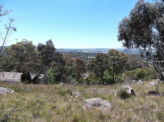
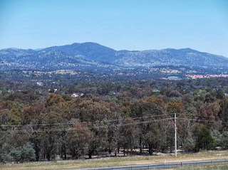
From this track until beyond the crest are wonderful views across the city and the ranges to the west.
The upwards track eventually intersects with a track running around a ridge.
The views along this section of the track are expansive.
 |
| Looking across Chapman towards the Woden town centre |
 |
| Yes, it really is Woden down there |
Having recently read about the scared trees in Wanniassa I was intrigued to see this tree and recognise that the scar just below the junctions of its fork is the same as those in Wanniassa. I must keep an eye out for other examples. These trees are older than the national capital.
I love spotting kangaroos on Mt Arawang. In the heat of the day they generally find shade and lie down and rest. Today these roos were happily grazing up near the top of Mt Arawang.
Continue following the track around the base of Mt Arawang and alongside the cut off drain. Just after the 4km mark you will reach a gate with a Park Care sign.
Pass around the gate and continue to follow the track.
You will now have views of Mt Taylor and the Tuggeranong Valley.
Near the 5km mark you will come across a foot bridge across the cut off drain.
Turn left away from the bridge onto a narrow track leading down to a step through in the fence.
Go through the fence and head up the track heading up the slight rise.
This track eventually heads down towards a fence and another step through.
After passing through the fence turn left and follow the track in a clockwise direction around the edge of the houses until you pass a gate and then come to a cement path.
Turn left onto the path, passing through a pair of posts. Note the blackening on the base of the left hand post caused during the 2003 fires that swept through this area.
Ahead of you is the Kambah Pool Road. Cross the road and then an open grassy area and you will reach houses. You can either wind your way through the houses or go around the edge of the houses. Whichever route you choose you will eventually reach Drakeford Drive and it is then only a short walk to the Kambah Village.


Brilliant walk. Thanks heaps. Gavin, Andrew and Ron.
ReplyDeleteVery informative and impressive post you have written, this is quite interesting and i have went through it completely, an upgraded information is shared, keep sharing such valuable information. Knock Down and Rebuild
ReplyDelete