Saturday, 28 December 2013

Canberra Centenary Trail - Section 6

Along with many other activities and permanent additions to Canberra, 2013 saw the creation of the Canberra Centenary Trail. This trail has been designed for walkers and cyclists. It is some 140km trail which takes you urban and nearby rural environments. The trail is broken into seven stages for walkers and 3 for cyclists although you can easily break some of the stages into shorter walks.

Trevor and I decided to tackle Section 6, the section from Stromlo Forest Park to the Tuggeranong Town Centre as this section is close to home, actually crossing our street only a few hundred metres from our house.

We picked 27 December 2013 for our walk. The weather was forecast to be clear and warm with the temperature expected to reach 30.

We left home just after 9am and headed off to the carpark in Stromlo Forest Park adjacent to the 2003 Bushfire Memorial.

When Trevor got his pack out of the car he noticed that it was wet. He was not sure why. Later he determined that the cap on his water bladder had leaked and that he probably had lost about half of his water. Not good on a hot day. If the water problem had been solved earlier we could have topped up the water. By the time the problem was solved Trevor had no water left and we had no way of supplementing it.

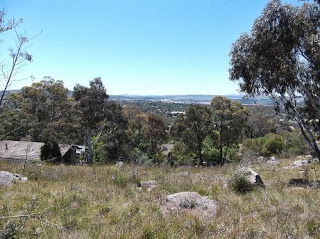
Leaving from the car park we headed towards Duffy. Crossing the Cotter Road we headed along Eucumbene Drive, passing the very familiar houses along that street. The views over the Canberra urban area from the vantage point on the western side of the road never disappoint.

Trevor heading up the track along Eucumbene Drive

View from Eucumbene Drive
 Narrabundah Hill, on the western side of Eucumbene Drive, was devastated by the fires in early 2003. The pine plantations, which were a feature of the hillside, were destroyed. They have been replaced by other trees and these are now beginning to look like a forest.

Trees on Narrabundah Hill
The Canberra Centenary Trail is marked by guide posts. Here is an example near the Eucumbene Drive-Hindmarsh Drive intersection.


Crossing Hindmarsh Drive the trail meandered through an open grassy area before picking up a trail alongside Kathner Street in Chapman. This trail took us up onto Cooleman Ridge.


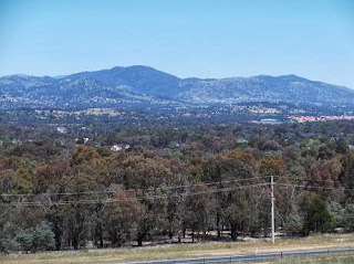
The trail wandered over the ridge. I was a little disappointed that it did not follow the track along the western side of the ridge as I feel that the views across the rangers are superior to views across the urban areas of the city. Still, we did cross the ridge a number of times so got bits of the ranges to the west as well as the city to the east.

We took our first break on Cooleman Ridge. Along with our water we had also taken coffee and hot water for tea. The first break was coffee and perked us up.

Trevor enjoying a cuppa
The trail headed over to the western side of the ridge and I came across a storyboard which named each of the peaks which were visible from the point. A number of the peaks I had already climbed. Others are on my to do list.

Looking at the ranges to the west
While the trail has just been completed much of it is rough and care is required to ensure that you do not slip or trip.


Cooleman Ridge is strewn with boulders and large areas of rocks

On the eastern side of Cooleman Ridge again with views across to Black Mountain and its tower
On reaching Mt Arrawang, walkers were directed down the stepped path to the Stanhope Highway and a clockwise circuit of the mound. The signs direct walkers down on to Namatjira Drive however if you ignore that sign, as we did, there is another sign indicating that you can continue following the fire trail around the base of Mt Arrawang. The views, and walking conditions too, from the fire trail are far superior to lower route. There was no contest.

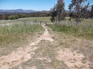
When we reached the bridge across the drain to the summit track we turned left of the trail and headed through the horse paddock and then down to Kambah Pool Road. Crossing the road we walked along the path which runs on the western side of the Kambah houses, crossing Barritt and heading down towards Kambah Pool. This was one of the few places where the trail was indistinct.

We took another break in the shade of some trees just before we reached the Murrumbidgee Country Club. The flies were a nuisance and we were glad of our fly nets. The odd fly still managed to attempt to become human food.

The Murrumbidgee County Club is a green oasis in an otherwise dry landscape
Passing alongside the Murrumbidgee Country Club we observed quite a few people out playing golf.

The views from the narrow path alongside the Kambah Pool Road took in both the western ranges as well as the rural properties and the odd hill. With the exception of the golf course, the countryside was looking very dry. The grass is quite long and an obvious fire hazard.


It was quite a trudge along the Kambah Pool Road and I was pleased to finally reach the entrance to the Kambah Pool Reserve.


We headed down towards the swimming area looking for somewhere is sit down and have our lunch. We didn't find any tables but there was a bench and we took advantage of it to sit down and have a break.

It is quite a climb down to the river level and we watched a number of people trudging up and down the path. Most of the visitors seemed to be fisher persons.

One of the many fishermen leaving Kambah Pool
 The one good feature of our visit to the Kambah Pool Reserve was the toilet. Definitely a bonus!

After lunch we headed along the Murrumbidgee River towards the Tuggeranong Town Centre. The track had been designed to have relatively gentle gradients and this meant that it is mostly away from the river. When Michael and I had done the Red Rocks Gorge walk back in 2012 we had tracked fairly close to the river with reasonably constant views of the water and excellent views of the Red Rocks area. The Centenary Trail was disappointing as it does not allow a good view of the most startling of the gorge features. When I get a chance I'll go back and do the walk along the gorge proper to highlight the differences.

On the left hand side, in the middle, is a heap of dead trees that have collected on the riverbank


There was very little waterflow in the river although we had had some recent rain.

Christmas Bush in flower


When we drove through Cann Valley last weekend we noticed all the Christmas Bush coming in out in flower. On our return trip it was even more evident. There was quite a lot of this bush in flower along the Murrumbidgee corridor. Along with the Christmas Bush there was an array of plants in flower. They were a pleasant interlude in an increasingly hot day.

About this time Trevor discovered that he was completely out of water. I shared my remaining water with him but he exhausted that supply before reaching our destination.

Views of the river were limited and mostly obscured by vegetation. There were a number of spots where we could see the water and the walls of the gorge although few offered reasonable points for photographs.


Yes, there is white water in the centre of this photo

The rocks in the centre of this photo are an outstanding feature of this section of the gorge. A pity that we never had a good view of them

From time to time we caught glimpses of our destination, the Tuggeranong Town Centre. It always seemed to be off in the distance.

At one point, on a wide sweeping bend of the river, a huge beach of sand was visible.


The trail meandered between the river and the back of the town centre. It would be possible to cut up onto Athlon Drive and save a couple of ks from the walk however we continued to follow the set trail. This took us along the original boundary fence that was erected between 1867 and 1875 between the two large runs that occupied much of the area, namely the Lanyon and Yarralumla properties.


Finally we arrived at the town centre and were able to rehydrate and grab a refreshing coffee before getting a bus home and then going back to Stromlo Forest Park to collect Trevor's car.

All up we had walked 22kms with 430m elevation gain and 441m loss. The temperature had reached 30.

While we will probably tackle the other 6 stages of the full Canberra Centenary Trail I don't anticipate repeating this section. There are better tracks with far better views in the area covered by Section 6. I suspect that the route has been compromised by the need to cater for bikes rather than just walkers. Like many challenges, it is worth tackling at least once and then adding your own variations to subsequent hikes.

Canberra’s Centenary Trail will showcase the true ‘Bush Capital’, taking you on an exploration of the national capital’s natural areas and iconic landmarks.
The 140 kilometre self‑guided trail takes walkers and cyclists on a journey through urban and nearby rural environments. It passes by well‑known locations and hidden treasures and through the urban grandeur of the Parliamentary Zone as well as the quiet beauty of Canberra’s nature reserves.
The trail will have a symbolic start and stop point within the Parliamentary Zone and loop around the Australian Capital Territory (ACT) through locations including ANZAC Parade and the Australian War Memorial, Lake Burley Griffin, the National Arboretum, Stromlo Forest Park and Mulligans Flat Sanctuary. The well planned landscape of Canberra's city will be on show from Black Mountain, Mount Majura and Dairy Farmers Hill lookouts as well as from other high points along the trail.
You can join or leave the trail at many locations and complete as little or as much of the trail as you like. The trail is divided into daily legs, spaced to allow walkers and cyclists a full day of sightseeing. Completing the full trail loop around the ACT will take an average of seven days for walkers and three days for cyclists.
- See more at: http://www.canberra100.com.au/programs/centenary-trail/#sthash.xAxIwXKa.dpuf
Canberra’s Centenary Trail will showcase the true ‘Bush Capital’, taking you on an exploration of the national capital’s natural areas and iconic landmarks.
The 140 kilometre self‑guided trail takes walkers and cyclists on a journey through urban and nearby rural environments. It passes by well‑known locations and hidden treasures and through the urban grandeur of the Parliamentary Zone as well as the quiet beauty of Canberra’s nature reserves.
The trail will have a symbolic start and stop point within the Parliamentary Zone and loop around the Australian Capital Territory (ACT) through locations including ANZAC Parade and the Australian War Memorial, Lake Burley Griffin, the National Arboretum, Stromlo Forest Park and Mulligans Flat Sanctuary. The well planned landscape of Canberra's city will be on show from Black Mountain, Mount Majura and Dairy Farmers Hill lookouts as well as from other high points along the trail.
You can join or leave the trail at many locations and complete as little or as much of the trail as you like. The trail is divided into daily legs, spaced to allow walkers and cyclists a full day of sightseeing. Completing the full trail loop around the ACT will take an average of seven days for walkers and three days for cyclists.
- See more at: http://www.canberra100.com.au/programs/centenary-t
Canberra’s Centenary Trail will showcase the true ‘Bush Capital’, taking you on an exploration of the national capital’s natural areas and iconic landmarks.
The 140 kilometre self‑guided trail takes walkers and cyclists on a journey through urban and nearby rural environments. It passes by well‑known locations and hidden treasures and through the urban grandeur of the Parliamentary Zone as well as the quiet beauty of Canberra’s nature reserves.
The trail will have a symbolic start and stop point within the Parliamentary Zone and loop around the Australian Capital Territory (ACT) through locations including ANZAC Parade and the Australian War Memorial, Lake Burley Griffin, the National Arboretum, Stromlo Forest Park and Mulligans Flat Sanctuary. The well planned landscape of Canberra's city will be on show from Black Mountain, Mount Majura and Dairy Farmers Hill lookouts as well as from other high points along the trail.
You can join or leave the trail at many locations and complete as little or as much of the trail as you like. The trail is divided into daily legs, spaced to allow walkers and cyclists a full day of sightseeing. Completing the full trail loop around the ACT will take an average of seven days for walkers and three days for cyclists.
- See more at: http://www.canberra100.com.au/programs/centenary-trail/#sthash.xAxIwXKa.dpuf

Thursday, 12 December 2013

November?

It is already the middle of December and I haven't posted anything about November.

My statistics are all mucked up as Runtastic has managed to show May as a second April and all subsquent months are showing as the previous. That was certainly truw through to October which is just not showing at all. November does seem to be there.

What did I do during November?

My pattern has been dictated by Wednesdays walking the 6km to the gym, working with my PT and then walking the 6ks home. Often I do another 6ks following lunch and then a stroll to the Village later in the day. Wednesday is consistently my high distance day of the week.

Along with my Wednesday activities I did a couple of long walks.

On Sunday 3rd I worked at a swim meet out at the AIS which finished around 3pm. I took the opportunity to walk home. This was interesting as the first part of the walk took me through reserves and then through the suburb of Turner. I skirted around Civic by taking the road that runs between ANU and Black Mountain before doing an anti clockwise segment around Lake Burley Griffin. I picked up a path along the Molonglo River. Which was pretty quiet until I encountered a group of 50 or so bike riders who appeared to be doing a bike tour. I managed to navigate my way through Molonglo without trespassing on any construction sites and then on to Cooleman Court before picking up my regular route from the Weston Creek centre home.

All up this walk was 22.63kms with 309m in elevation gain and 309m elevation loss.

When setting out Trevor had asked when to expect me home. I told him that I thought I would be home by 7pm and I was right on time. It was a lucky guess at how long it would take me to do the walk as I had not determined exactly how far it would be.

I continue to do Mt Taylor Circuits. These some in at around 9.5km with an elevation gain and loss of about 170m. I added a climb up the Richmond Fellowship Track on one of my circuits which adds a further 135m to the elevation gain.

During the month I only walked 242.88km with an overall elevation gain of 3456m.

I'll add some photos in sometime when I get a chance to edit them.

Friday, 15 November 2013

October was a funny month

I have just realised that I had not looked at my statistics for October. On reviewing them I could but conclude that October had been a funny month.

At the start of the month we were in Jordan. While we did quite a bit of walking it was generally in dribs and drabs and was a lot of stopping and starting as we looked at things. Except for the two days we were in Petra I did not track how far I walked. The first day we were in Petra I clocked up 12.5km while the second day scored 7.19km. I suspect that I had lost some distance on that second day.

It wasn't until I got home that I started tracking may walking. Even then there were days with no recorded walks.

I did do one long walk from the National Library home which was 16kms.

All up I recorded a mere 195.07km for the month.

I still believe that I am very lucky to have such a wonderful environment in which to walk. There are so many lovely walks and wonderful views that it is always a pleasure to be out and about.

Having done the Coast to Coast and survived I decided that it was time to pick another walking challenge and I decided that Tasmania in January would do the trick. Trevor is coming too so we are both back in training for climbs as there are a number of peaks that can be tackled. The trip starts in Hobart and finishes in Launceston and takes in Lake Pedder and Lake St Clair as well as Cradle Mountain. We are doing it in comfort by staying in comfortable accommodation rather than tents. It adds to the cost of the trip but creature comforts are welcome at the end of a tough day on the trail.

Wednesday, 30 October 2013

Cooleman Court to Kambah via the Stanhope Highway

One of my frequent walks is from Cooleman Court in the heart of Weston Creek home to Kambah. While I have experimented with routes between these points the one which I enjoy the most is the one that takes me past the Chapman shops and along the Stanhope Highway.

[Note: The Stanhope Highway is the wide fire trail that skirts the cut-off drain around the base of Cooleman Ridge and Mt Arawang. The Stanhope highway is not its official name but is a term provided by a local wag.]

From Cooleman Court home is a shade over 6km. If you were to finish at the Kambah Village instead you would probably add about .5km to that distance.


Starting from the southern entrance/exit of Cooleman Court head south towards Hindmarsh Drive. You need to cross Parkinson Street, one of the very few road crossing on this walk.
Parkinson Street
Once across Parkinson Street head towards Hindmarsh Drive and pass through the underpass.

Follow the path through a open space keeping to the path running on the right hand side of the open space.
When you finally run out of fences turn right into a cul de sac.
Keep to the left hand side of the roads until you reach the other side and enter a path heading down towards Fremantle Drive.
This path leads down to Fremantle Drive
 Go through the Fremantle Drive underpass
Continue ahead along a path that runs between the Canberra College Weston Campus and a fence which eventually is taken over by a hedge.
As you near the Stirling Ovals you will completed 1 km of the walk. At this point you will be confronted with a muddle of paths.
Continue until the path you are on intersects with a path running along the edge of the ovals/netball courts. Turn left.
Follow the path until it makes a sharp turn to the left.
Veer off the cement path onto a dirt track leading in a southerly direction through the trees.
The surface of this track is a little uneven. Take care along this section. Tree roots often are exposed and can catch the toe of unwary walkers/runners.

Continue along this dirt track until it meets a cement path. Cross the path and then turn right on the next path you come to.
Follow the cement path until you encounter another underpass on your right.
Go through the underpass. This takes you under Streeton Drive.
You will now have the Chapman Primary School and Pre-School on the left hand side of the path. To the right are the Chapman shops.
The path curves around the Chapman Pre-school

You have now gone 2km. If you want a break there is a bakery that also serves coffee and the Chapman Takeaway as well as an IGA Supermarket.

Back on track, the path goes through a final underpass  taking you under Perry Drive.
Take the path which is almost straight ahead with a slight veer to the left.

This path continues to the left of a series of fences and climbs gradually at first and then more steeply as it nears a series of steps.
If you are not used to climbing remember to take your time on the section between the Perry Drive underpass and the top of the climb. All up you will be gaining 68m in elevation. Take the time to stop, catch your breath and look back down into Weston Creek.

The final set of steps brings you out at a path. Turn right for a few steps and then head up a dirt track under the powerlines and alongside a garden.
You will pass a marker post indicating that you are entering one of the many Canberra nature reserves.
Continue to the left of this post climbing towards the crest.
The main track is covered with loose material and is quite badly rutted. Walkers have forged a track along the right side of the main track. Take this narrower track as it is easier walking.
From this track until beyond the crest are wonderful views across the city and the ranges to the west.

The upwards track eventually intersects with a track running around a ridge.
At the point where the upward track intersects with the track you will see a post with a 1 on it. To the left is a post with a box on top with may contain a pamphlet for a guided walk around this section of the reserve
Turn left. This wide track leads down and eventually levels out. A drain will appear between the track and the up slope. While this wide track is actually an access track the sheer size of the track has prompted it to be named "The Stanhope Highway" by a number of the locals.

The views along this section of the track are expansive.
Looking across Chapman towards the Woden town centre
Yes, it really is Woden down there
It is possible to see across to Black Mountain, the flag on the top of Parliament House, the Captain Cook Waterjet when it is operating, Red Hill and much more.

Having recently read about the scared trees in Wanniassa I was intrigued to see this tree and recognise that the scar just below the junctions of its fork is the same as those in Wanniassa. I must keep an eye out for other examples. These trees are older than the national capital.
I love spotting kangaroos on Mt Arawang. In the heat of the day they generally find shade and lie down and rest. Today these roos were happily grazing up near the top of Mt Arawang.

Continue following the track around the base of Mt Arawang and alongside the cut off drain. Just after the 4km mark you will reach a gate with a Park Care sign.
Pass around the gate and continue to follow the track.

You will now have views of Mt Taylor and the Tuggeranong Valley.
Near the 5km mark you will come across a foot bridge across the cut off drain.
Turn left away from the bridge onto a narrow track leading down to a step through in the fence.
Go through the fence and head up the track heading up the slight rise.
This track eventually heads down towards a fence and another step through.
After passing through the fence turn left and follow the track in a clockwise direction around the edge of the houses until you pass a gate and then come to a cement path.
Turn left onto the path, passing through a pair of posts. Note the blackening on the base of the left hand post caused during the 2003 fires that swept through this area.

Ahead of you is the Kambah Pool Road. Cross the road and then an open grassy area and you will reach houses. You can either wind your way through the houses or go around the edge of the houses. Whichever route you choose you will eventually reach Drakeford Drive and it is then only a short walk to the Kambah Village.